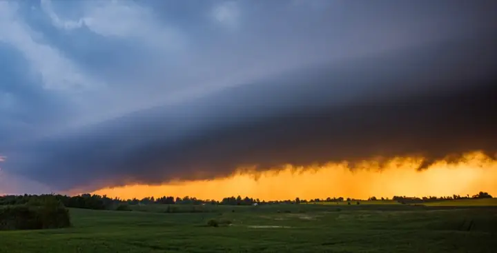
In short: an outlook says severe storms are possible in the coming days, a watch says the ingredients are coming together over the next few hours, and a warning says it is happening or about to happen at your location. Aware, ready, act. Mixing up the last two is the most common and most dangerous weather mistake.
The U.S. severe weather alert system is a funnel that narrows in space and time: outlooks cover states and days, watches cover regions and hours, warnings cover neighborhoods and minutes. Each level has a specific meaning and a specific correct response.
The one-line version
- Outlook = “these days/areas have severe potential” → stay aware
- Watch = “conditions are favorable for severe storms over the next several hours” → be ready
- Warning = “it is happening or imminent at your location” → act now
Outlooks: days ahead
The Storm Prediction Center (SPC) in Norman, Oklahoma issues convective outlooks up to 8 days out. Days 1 to 3 get categorical risk levels, and Days 4 to 8 are probability only. Worth knowing before you go hunting for one: Day 3 stops at Moderate, and a Day 2 High risk has been issued only three times (for April 7, 2006, April 14, 2012 and March 15, 2025). In practice a High risk is a Day 1 product.
| Level | Name | What it means in practice |
|---|---|---|
| 1 | Marginal | Isolated severe storms possible, limited in intensity |
| 2 | Slight | Scattered severe storms; some organized threats |
| 3 | Enhanced | Numerous severe storms, more persistent/widespread |
| 4 | Moderate | Widespread severe likely, some significant/intense |
| 5 | High | A severe weather outbreak expected. A few days a year at most, and some years none at all |
Where people go wrong:
- The scale is about coverage as much as intensity. A violent tornado can absolutely happen on a Slight day. Level 2 means fewer storms, not weak ones. Read the accompanying probabilities (tornado / wind / hail percentages) for the real threat picture.
- Enhanced and above deserve planning. On a Level 3+ day over your area, know where you’d shelter, keep devices charged, and don’t schedule yourself somewhere you can’t receive alerts.
For flooding, the Weather Prediction Center issues a parallel outlook, the Excessive Rainfall Outlook.
Watches: hours ahead
When the environment comes together, SPC issues a Severe Thunderstorm Watch or Tornado Watch, typically a region covering parts of several states, valid for a few hours, up to about eight. The dots are the colors the app draws each watch in. A watch means the ingredients are present; storms may not have even formed yet.
The enhanced wording Particularly Dangerous Situation (PDS) is added when forecasters have unusually high confidence in an extreme outcome. Most often that is a tornado watch expecting violent, long-track tornadoes, but PDS also appears on severe thunderstorm watches for high-end wind events, and on tornado warnings it marks the considerable damage tier, for a strong tornado on the ground. PDS tornado watches precede many historic outbreaks. Treat them with real gravity.
Correct response to a watch: go about your day, but with an exit plan. Know your shelter location, keep alerts on and audible, and check radar periodically. This is exactly the phase where reading the map yourself pays off: a radar loop tells you whether storms are forming and whether they’re coming your way.
Warnings: minutes ahead
Warnings come from your local NWS forecast office rather than SPC, and they’re polygon-shaped: drawn around the specific storm’s projected path. Tornado and severe thunderstorm warnings usually run 30 to 60 minutes; flash flood warnings often run several hours.
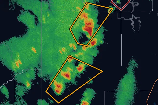
- Severe Thunderstorm Warning: a storm producing (or about to produce) hail ≥ 1″ and/or winds ≥ 58 mph. A considerable tag means 1.75″ hail or 70 mph wind. The destructive tag (2.75″ baseball hail or 80+ mph winds) is the only one that sets off Wireless Emergency Alerts. Treat destructive like a tornado warning; 80 mph straight-line wind does tornado-grade damage. A TORNADO…POSSIBLE line at the bottom means a brief tornado could form with little notice, most often in a line of storms.
- Tornado Warning: a tornado is occurring or radar shows one could form at any moment. The source line reads RADAR INDICATED (rotation, not yet confirmed) or OBSERVED (a reliable report, or radar-confirmed debris). A considerable damage threat, for a strong tornado on the ground, adds the words “particularly dangerous situation”.
- Tornado Emergency is the catastrophic tier: a violent tornado is on the ground, confirmed, and there is a severe threat to life and catastrophic damage, usually in a populated area. If you ever receive one, you are out of decision time.
- Flash Flood Warning: flash flooding is happening or about to. A considerable tag marks a serious threat to life and property; catastrophic comes with a Flash Flood Emergency. Phones get a Wireless Emergency Alert for either tag, not for the base warning. Water is the quiet killer in this list; on NWS 30-year averages, floods kill more Americans each year than tornadoes do. Never drive into flooded roadways. The NWS, citing the CDC, says more than half of flood drownings happen to people in vehicles, which makes it the single most common way flooding kills. Turn around, don’t drown.
Correct response to a warning: shelter first, verify later. Lowest floor, interior room, away from windows, and cover your head. A mobile or manufactured home is not safe in a tornado: leave for a sturdy building before the storm arrives, which is why the watch is the time to plan. In a vehicle, drive to a sturdy building if you can; never shelter under a highway overpass. Do not go outside to look, and do not wait for the radar to show you a hook echo. Warnings incorporate information you don’t have.
Tropical watches and warnings: days ahead
The National Hurricane Center issues these, with local NWS offices covering inland areas. They run on a clock of days, not minutes.
- Tropical Storm Watch / Warning: winds of 39 to 73 mph possible within 48 hours (watch) or expected within 36 hours (warning).
- Hurricane Watch / Warning: winds of 74 mph or more possible (watch, about 48 hours ahead) or expected (warning, about 36 hours ahead). The clock is set by when tropical-storm-force winds arrive, not hurricane-force ones, because that is when outdoor preparation becomes dangerous.
- Storm Surge Watch / Warning: life-threatening flooding from rising seawater moving inland, possible within 48 hours or expected within 36. Storm surge is the most common reason for coastal evacuations; evacuation orders come from local officials, so follow them.
- Extreme Wind Warning: issued by a local NWS office for the onset of extreme eyewall winds (115 mph or more sustained) within the hour. Shelter as you would for a tornado.
Hurricane and storm surge warnings can stay up after the wind drops if dangerous water remains. In MesoRadar, Extreme Wind Warnings are in the push set every plan gets; Hurricane, Tropical Storm and Storm Surge Warnings can be switched on under Alert types with Pro. How alerts work.
Building a redundant alert stack
Any single alert channel fails eventually: towers go down, phones silence themselves, power cuts out. The standard advice is at least three independent paths:
- Wireless Emergency Alerts (WEA): the built-in phone broadcast. It covers tornado warnings, destructive severe thunderstorm warnings, flash flood warnings tagged considerable or catastrophic, snow squall warnings tagged significant, and dust storm, extreme wind, hurricane, storm surge and tsunami warnings. Free, automatic; make sure it is switched on.
- A weather app with location-based push warnings: it checks the warning shape against the exact place you saved, and it can cover severe thunderstorm and flood warnings that WEA does not push. How MesoRadar’s work, including exactly which types buzz a free phone.
- NOAA Weather Radio: the battery-powered fallback that works when cell service doesn’t. Program it for your county; it will wake you at 3 a.m., which is the point. Overnight tornadoes are disproportionately deadly precisely because people are asleep and unreachable.
Sirens are outdoor warning systems. Never rely on hearing one indoors.
Key points
- Outlook → aware; Watch → ready; Warning → act
- SPC risk levels measure coverage as much as intensity; violent storms happen on Level 2 days
- Warning polygons are storm-specific; if you’re inside one, it’s about you
- Tornado Emergency and PDS wording are rare and mean exactly what they say
- Run three alert channels; one of them should work while you sleep
Sources
- SPC, frequently asked questions (outlooks, watches, PDS)
- SPC, convective outlook categories and probabilities
- NWS, severe thunderstorm and tornado warning basics
- NWS, flood safety: Turn Around Don't Drown
- NWS, weather fatalities by hazard, 30-year averages
- FEMA, Wireless Emergency Alerts
- NWS, Wireless Emergency Alerts: which warnings reach your phone
- NWS, Tornado Warning impact-based tags (source, considerable, catastrophic)
- NWS Paducah, damage threat categories for severe thunderstorm warnings
- NWS Directive 10-511, WFO severe weather products (warning durations)
- NWS, tornado safety: during a tornado (mobile homes, vehicles, overpasses)
- NWS, hurricane, tropical storm, storm surge and extreme wind watches and warnings
- NHC, glossary of tropical products
- WPC, Excessive Rainfall Outlook